

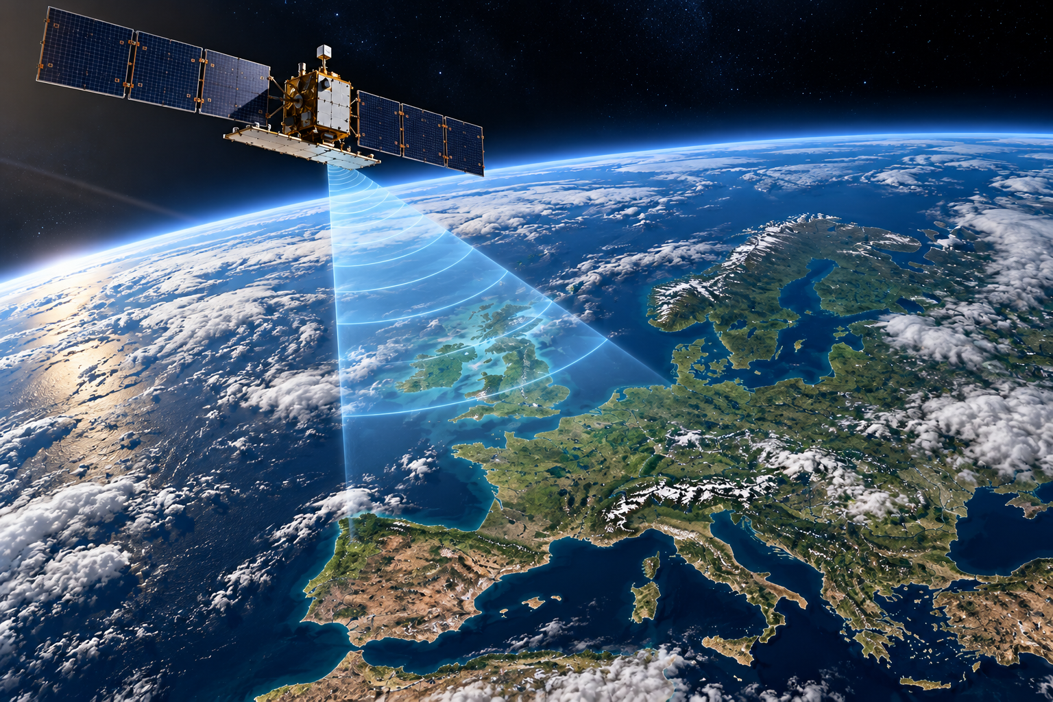
Satellite Radar, SAR & Earth Observation
Introduction
Satellites have transformed humanity's ability to observe and understand Earth. From monitoring climate change and tracking environmental damage to mapping terrain, detecting ground movement and supporting disaster response, satellite-based observation systems provide information that would be difficult or impossible to obtain using ground-based instruments alone.
Among the most important technologies is Synthetic Aperture Radar (SAR), a form of radar imaging that uses microwave signals to produce detailed images of Earth's surface. Unlike conventional optical cameras, SAR does not require sunlight and can operate during both day and night. Its microwave signals can also penetrate clouds, allowing observations in conditions that would obstruct many optical satellite systems.
Europe, including the United Kingdom, plays a major role in developing and operating these technologies. The European Space Agency (ESA), the European Union's Copernicus programme, national space agencies, research institutions and commercial satellite operators contribute to an expanding network of Earth-observation capabilities.
European missions such as Sentinel-1 demonstrate how satellite radar can support environmental monitoring, maritime surveillance, infrastructure assessment and the measurement of changes in Earth's surface.
More advanced techniques, including radar interferometry, allow scientists to measure extremely small changes in ground position by comparing radar observations collected at different times. These capabilities have applications in earthquake research, volcanic monitoring, land subsidence and infrastructure safety.
This article examines the science behind satellite radar and SAR, the development of European and UK Earth-observation systems, their established civilian and security applications, and the technologies shaping the next generation of European satellite observation.
How Satellite Radar and Synthetic Aperture Radar Work
The Principles of Satellite Radar
Radar, short for Radio Detection and Ranging, uses electromagnetic waves to detect objects and measure their distance from a transmitting system.
An active radar satellite transmits radio-frequency signals towards Earth's surface and records the echoes reflected back towards its antenna. By analysing the time taken for these signals to return, along with their strength, phase and frequency characteristics, the satellite can obtain information about the observed environment.
Unlike optical imaging systems, radar does not depend on reflected sunlight. This allows radar satellites to operate during the day or night and, at suitable microwave frequencies, observe Earth's surface through cloud cover.
However, radar does not simply produce conventional photographs. Its measurements represent the interaction between electromagnetic waves and the surfaces or objects being observed. The resulting images require processing and interpretation.
Synthetic Aperture Radar (SAR)
Synthetic Aperture Radar is an advanced imaging technique that combines radar measurements collected as a satellite moves along its orbit.
A conventional radar system's ability to distinguish objects in the direction of travel is influenced by the physical size of its antenna. SAR overcomes much of this limitation by combining successive radar echoes to synthesise the performance of a much larger antenna.
As the satellite travels, it observes the same area from slightly different positions. Sophisticated signal-processing algorithms combine these measurements, using their phase and timing information to construct a high-resolution radar image.
This technique allows satellites to produce detailed observations without requiring antennas hundreds of metres long.
SAR images can reveal coastlines, buildings, agricultural land, forests, sea ice and other surface features. Their appearance depends on factors including surface roughness, moisture, geometry and the radar wavelength used.
Radar Frequencies and Penetration
Satellite radar systems operate at different microwave frequencies, selected according to the mission's scientific or operational objectives.
Common frequency bands include:
- X-band: Often used for high-resolution radar imaging, including detailed mapping and maritime applications.
- C-band: Used by Europe's Sentinel-1 satellites for applications including environmental monitoring, sea-ice observation and surface deformation measurements.
- L-band: Uses longer wavelengths that can penetrate vegetation more effectively than shorter-wavelength radar, supporting applications such as forest and land-surface monitoring.
The ability of radar signals to penetrate materials depends on their wavelength and the electromagnetic properties of the material.
Although some radar frequencies can penetrate vegetation, snow or dry surface materials to varying degrees, conventional Earth-observation SAR cannot routinely see through buildings or deeply underground.
Radar Interferometry (InSAR)
One of SAR's most important scientific applications is Interferometric Synthetic Aperture Radar, commonly abbreviated to InSAR.
InSAR compares the phase information contained in radar observations of the same location, collected from different satellite positions or at different times.
By analysing differences between these measurements, scientists can estimate changes in the distance between the satellite and Earth's surface.
Under suitable conditions, these techniques can detect ground displacement at centimetre or even millimetre scales. Repeated observations are particularly valuable for measuring gradual movement over time.
European researchers and monitoring services use InSAR for applications including:
- Measuring land subsidence associated with groundwater extraction or mining.
- Monitoring ground deformation around volcanoes.
- Studying displacement caused by earthquakes.
- Assessing movement affecting infrastructure and urban areas.
- Monitoring changes in glaciers and other natural environments.
Measurement accuracy depends on factors including atmospheric conditions, surface stability, satellite geometry and the availability of suitable observations.
From Radar Signals to Earth-Observation Data
The information collected by radar satellites must undergo substantial processing before it becomes useful.
Radar echoes are converted into digital measurements and processed to correct for satellite movement, imaging geometry and other factors affecting the observations.
Further analysis can produce radar images, elevation information, displacement measurements and maps of environmental change.
Artificial intelligence and automated processing systems can assist with identifying patterns, classifying features and detecting changes across large datasets.
However, reliable interpretation still requires appropriate calibration, validation and an understanding of the limitations of the underlying measurements.
Together, these technologies make satellite radar an important component of Europe's Earth-observation infrastructure, supporting scientific research, environmental management, civil protection and security-related applications.
European and UK Satellite Radar Programmes
Europe has developed a substantial satellite radar capability through cooperation between the European Space Agency (ESA), the European Union, national space agencies, universities and commercial companies.
These programmes range from large scientific satellites designed for long-term environmental monitoring to commercial constellations capable of collecting radar imagery for customers around the world.
Copernicus Sentinel-1 — European Radar Earth Observation
The Sentinel-1 mission is part of Copernicus, the European Union's Earth-observation programme, developed in cooperation with ESA.
Sentinel-1 satellites carry C-band Synthetic Aperture Radar instruments capable of observing Earth's surface during both day and night, including through cloud cover.
The mission supports applications such as:
- Monitoring land movement caused by earthquakes, volcanic activity and subsidence.
- Tracking sea ice and supporting maritime safety.
- Mapping flooding and other natural disasters.
- Observing changes in land use and environmental conditions.
- Supporting European scientific research and operational monitoring services.
Sentinel-1A was launched in 2014, followed by Sentinel-1B in 2016. Sentinel-1B subsequently experienced an instrument failure and its mission ended.
Sentinel-1C was launched in December 2024, restoring the mission's two-satellite operational configuration alongside Sentinel-1A.
The Sentinel-1 programme demonstrates how radar satellites can provide systematic, long-term observations that support both scientific research and public services.
TerraSAR-X and TanDEM-X — Germany
Germany has played an important role in advancing high-resolution satellite radar.
TerraSAR-X, launched in 2007, was developed through cooperation between the German Aerospace Center (DLR) and industry.
It uses X-band Synthetic Aperture Radar to obtain detailed observations of Earth's surface.
TanDEM-X, launched in 2010, operates in coordination with TerraSAR-X. The two satellites have been used to collect interferometric measurements for producing highly accurate digital elevation models.
Their achievements include the development of a global digital elevation model, supporting terrain analysis, scientific research and geographical applications.
These missions demonstrate Europe's established expertise in precision radar imaging, interferometry and satellite formation flying.
ICEYE — Finland
ICEYE is a Finnish-founded satellite company specialising in Synthetic Aperture Radar technology.
The company develops and operates compact SAR satellites and provides radar imagery and analytical services.
Its satellite constellation enables observations of selected locations under a wide range of lighting and weather conditions.
ICEYE's technology supports applications including flood monitoring, disaster response, maritime observation, infrastructure assessment and security-related intelligence.
Commercial SAR constellations represent an important development because they can provide more frequent observations than individual satellites operating alone.
However, revisit frequency, image resolution and coverage depend on the satellite configuration, operating mode and tasking arrangements.
Capella Space and the European Context
Although Capella Space is an American company rather than a European operator, its development of commercial SAR constellations illustrates the wider international expansion of compact radar satellites.
For this article, the principal focus remains on European capabilities, particularly ESA missions, German radar programmes and Finnish commercial developments.
United Kingdom — Research, Applications and Satellite Technology
The United Kingdom contributes to European Earth observation through satellite engineering, scientific research, data processing and commercial applications.
British universities and research institutions use satellite radar measurements to study earthquakes, volcanic deformation, landslides, ground subsidence and environmental change.
The UK also participates in ESA programmes and has supported the development of Earth-observation technologies and services through government funding, research organisations and the domestic space industry.
One important British contribution is the development of methods for processing large collections of satellite radar observations to identify gradual changes in Earth's surface.
These techniques can support infrastructure monitoring, geological research and environmental risk assessment.
UK organisations also use radar satellite data for maritime surveillance, flood mapping and geospatial analysis.
It is important to distinguish between organisations that manufacture or operate radar satellites and those that develop applications using satellite data. Both contribute to the wider Earth-observation sector, but their technological roles are different.
The Importance of European Satellite Cooperation
European satellite radar capabilities are strengthened by cooperation between public institutions, scientific organisations and commercial operators.
Public programmes such as Copernicus provide systematic observations and extensive open-data resources, while commercial operators can offer specialised imaging services and additional observation opportunities.
Together, these systems support Europe's ability to monitor its environment, respond to natural disasters, conduct scientific research and develop independent space-based observation capabilities.
Their continued development also contributes to European technological expertise in radar engineering, advanced electronics, satellite manufacturing, signal processing and geospatial computing.
Advanced SAR Capabilities and Applications
Satellite radar has developed far beyond producing images of Earth's surface. Modern Synthetic Aperture Radar (SAR) systems can detect environmental changes, measure ground displacement, identify certain types of objects and provide information that supports scientific research, infrastructure management and national security.
European satellite missions and commercial operators are increasingly combining radar observations with advanced computing, automated analysis and other sources of geographical information.
Change Detection and Environmental Monitoring
One of SAR's most valuable capabilities is identifying changes between observations collected at different times.
By comparing radar images, scientists can detect alterations in surface conditions, including flooding, land disturbance, changes in vegetation and damage caused by natural disasters.
Radar is particularly useful for flood monitoring because it can collect observations through cloud cover, which frequently accompanies severe weather.
Water surfaces often produce relatively weak radar returns under suitable viewing conditions, helping analysts distinguish flooded areas from surrounding land. However, buildings, vegetation, wind and surface geometry can complicate interpretation.
Europe's Copernicus Sentinel-1 programme provides important data for these applications, supporting environmental research and emergency mapping services.
Maritime Surveillance and Ship Detection
SAR satellites can observe large maritime areas without depending on daylight or clear skies.
Ships may appear as distinctive radar reflections against the surrounding sea surface, allowing suitable imaging systems to detect and locate vessels.
European organisations use satellite radar for applications including maritime situational awareness, fisheries monitoring, pollution detection and support for maritime security.
Radar imagery can also be combined with Automatic Identification System (AIS) transmissions, which provide vessel identification and movement information.
Comparing satellite observations with AIS records can help analysts identify vessels that are not broadcasting expected identification signals.
However, detecting a vessel in a radar image does not automatically establish its identity, intentions or activities. Reliable interpretation may require additional observations and independent information.
Infrastructure Monitoring and Ground Movement
Satellite radar interferometry can measure gradual movement affecting buildings, transport networks and surrounding terrain.
Repeated SAR observations allow scientists to estimate ground displacement over time, potentially identifying subsidence, slope instability or other changes.
European services such as the Copernicus European Ground Motion Service use satellite radar observations to provide ground-motion information across Europe.
These measurements can assist with the assessment of:
- Urban land subsidence.
- Railway and road corridors.
- Dams and surrounding terrain.
- Mining-related ground movement.
- Landslides and geological instability.
- Areas affected by groundwater extraction.
Satellite measurements do not replace structural inspections or engineering assessments. They provide an additional source of information that can help identify locations requiring closer investigation.
Artificial Intelligence and Automated Radar Analysis
SAR satellites generate substantial quantities of data that require specialist processing and interpretation.
Artificial intelligence and machine-learning techniques are increasingly used to assist with tasks such as image classification, object detection, flood mapping and identifying changes between observations.
European research institutions and commercial operators are developing methods that combine radar measurements with optical satellite imagery, geographical databases and other environmental information.
Such approaches can help analysts examine large geographical areas more efficiently.
However, automated systems can produce false detections or misinterpret radar reflections. Their reliability depends on training data, validation, imaging conditions and the intended application.
Artificial intelligence therefore complements radar measurement and scientific interpretation rather than eliminating the need for human expertise.
Radar Polarimetry
Radar polarimetry examines how transmitted and reflected electromagnetic waves behave at different polarisations.
Different surfaces and materials can alter the polarisation of radar signals in characteristic ways.
By analysing these responses, researchers can obtain additional information about vegetation, soil conditions, surface structure and other environmental features.
European SAR missions and research programmes use polarimetric techniques to improve the interpretation of radar observations.
The information obtained depends on the radar instrument, available polarisation modes and the characteristics of the observed surface.
Satellite Radar and Security Applications
SAR is also an established dual-use technology, meaning that the same underlying capabilities can support civilian and security-related applications.
Radar satellites can contribute to monitoring maritime activity, observing changes at facilities, assessing disaster damage and providing geographical information for defence planning.
European commercial SAR providers, including ICEYE, operate in markets that include government and security customers.
Repeated observations can help analysts identify visible changes at locations of interest, although satellite radar does not provide continuous live surveillance of every location.
Its capabilities are constrained by orbital coverage, revisit opportunities, resolution, imaging geometry and data-processing requirements.
Combining Radar with Other Earth-Observation Systems
Some of the most useful results emerge when SAR observations are combined with other technologies.
Optical satellites provide imagery that can assist with identifying visible surface features, while thermal instruments, atmospheric sensors and geographical databases contribute different types of information.
Combining these measurements can improve environmental monitoring, disaster assessment and broader situational awareness.
European programmes such as Copernicus demonstrate the value of integrating observations from multiple satellite instruments.
This approach is also relevant to the development of digital representations of physical environments, where regularly updated observations contribute to computer-based models.
However, a collection of satellite observations is not automatically a complete digital twin. A functioning digital twin generally requires an organised model, suitable data integration and mechanisms for updating or analysing the represented system.
Together, these advanced capabilities demonstrate how satellite radar has become an important part of Europe's scientific, environmental and technological infrastructure.
Recent European Developments and the Future of Satellite Radar
Updated October 2026
Europe's satellite radar capabilities are advancing through new Copernicus missions, specialised scientific instruments and the expansion of commercial SAR services.
Recent developments demonstrate how European organisations are improving the frequency, precision and scientific value of radar observations, while preparing technologies for future Earth-observation systems.
Sentinel-1D — Expanding Europe's Operational Radar Capability
On 4 November 2025, the European Space Agency successfully launched Sentinel-1D aboard Europe's Ariane 6 rocket.
The satellite joined the Copernicus Sentinel-1 programme, providing additional C-band Synthetic Aperture Radar capability for environmental monitoring, disaster response and maritime observation.
In April 2026, Sentinel-1D data became available through the Copernicus Data Space Ecosystem. ESA subsequently confirmed in May 2026 that the satellite had completed commissioning and become fully operational.
This development strengthened Europe's ability to maintain frequent, systematic radar observations of Earth's surface.
The expanded Sentinel-1 constellation supports applications including flood mapping, ground deformation analysis, sea-ice monitoring and environmental change detection.
Biomass — British-Built Radar Technology for Forest Monitoring
One of Europe's most significant recent scientific achievements is ESA's Biomass satellite, launched on 29 April 2025.
Developed under the leadership of Airbus in the United Kingdom, Biomass carries the first P-band Synthetic Aperture Radar instrument deployed in space.
P-band radar uses longer wavelengths than the C-band and X-band systems commonly employed in satellite Earth observation.
These longer wavelengths allow radar signals to penetrate forest canopies and obtain information about woody structures, including trunks and branches.
The mission is designed to improve estimates of forest biomass and the carbon stored in vegetation, helping scientists understand changes in Earth's carbon cycle.
In January 2026, ESA announced that Biomass had completed commissioning and its scientific data were becoming openly available.
By April 2026, ESA was highlighting observations collected during the satellite's first year in orbit.
Biomass demonstrates how European radar engineering can provide scientific measurements that are difficult to obtain using conventional optical satellites.
ROSE-L — Europe's Next Generation of L-Band Radar
The Radar Observing System for Europe in L-band, known as ROSE-L, is an upcoming Copernicus satellite mission.
Unlike Sentinel-1's C-band radar, ROSE-L will use longer-wavelength L-band signals to improve observations of vegetation, land surfaces and certain types of ground movement.
The mission is intended to support applications including forest monitoring, soil moisture assessment, agricultural research, geological hazard detection and maritime observation.
In April 2026, ESA reported a significant engineering milestone: the successful deployment test of a structural model of ROSE-L's large radar antenna.
The mission remains in development and should not be described as an operational satellite system.
ROSE-L is expected to complement existing European radar missions by providing measurements with different electromagnetic characteristics.
Commercial SAR Constellations and European Autonomy
European commercial satellite operators are also contributing to the expansion of radar Earth observation.
Finland's ICEYE has developed a constellation of compact SAR satellites that can be tasked to observe selected locations for applications including disaster response, insurance assessment, maritime monitoring and government intelligence.
Commercial constellations can improve observation opportunities by distributing imaging capabilities across multiple satellites.
This is particularly valuable when information is required quickly following a flood, earthquake or other significant event.
However, increased satellite numbers do not automatically provide continuous observation. Imaging opportunities still depend on orbital positions, tasking priorities, radar operating modes and available ground infrastructure.
Commercial radar services are becoming an important complement to Europe's publicly supported Earth-observation programmes.
Artificial Intelligence and Faster Data Processing
Another area of development is the use of artificial intelligence to process and interpret satellite radar measurements.
Machine-learning systems can assist with identifying ships, mapping flooded areas, classifying land cover and detecting changes between observations.
Future improvements may allow more analysis to take place directly aboard satellites, reducing the amount of raw data that must be transmitted to Earth.
Such systems could support faster delivery of useful information during emergencies or time-sensitive monitoring operations.
Nevertheless, automated interpretation must be validated carefully because radar images can contain ambiguous reflections, geometric distortions and other measurement uncertainties.
Future Research — Multi-Frequency Radar and Integrated Earth Observation
Europe's future radar capabilities are likely to benefit from combining observations collected at different wavelengths.
X-band, C-band, L-band and P-band radar instruments respond differently to vegetation, surface roughness and other environmental characteristics.
Combining suitable measurements can provide a more comprehensive understanding of Earth's physical environment.
Radar observations may also be integrated with optical imagery, meteorological information and geographical models to support more sophisticated environmental analysis.
These developments could contribute to increasingly detailed digital models of landscapes, infrastructure and natural systems.
However, such models depend on data quality, processing methods, update frequency and appropriate scientific validation.
Challenges Facing Future European Radar Systems
Despite substantial progress, satellite radar continues to face technical and operational challenges.
These include the cost of developing and launching spacecraft, maintaining satellite constellations, managing large quantities of data and ensuring the reliability of increasingly complex processing systems.
Radar observations also have inherent limitations associated with wavelength, imaging geometry, surface conditions and the time between acquisitions.
European programmes must additionally address orbital congestion, space debris and the long-term sustainability of satellite operations.
Continued cooperation between ESA, European governments, universities and industry will be important in addressing these challenges.
Outlook
As of October 2026, Europe possesses an established and expanding satellite radar infrastructure.
Sentinel-1D has strengthened operational C-band observations, Biomass has introduced spaceborne P-band radar for forest science, and ROSE-L is progressing towards future L-band observations.
Alongside commercial constellations and advances in computing, these developments are extending Europe's ability to monitor environmental change, investigate geological processes, support disaster response and maintain independent Earth-observation capabilities.
The next stage of progress will depend not only on launching more satellites, but also on improving how radar measurements are combined, interpreted and converted into reliable scientific and operational information.
Sources & Further Reading
European Space Agency (ESA). Sentinel-1: Radar Imaging for Copernicus.
German Aerospace Center (DLR). TerraSAR-X and TanDEM-X: German Radar Satellite Missions.
https://www.dlr.de/en/research-and-transfer/projects-and-missions/tandem-x
ICEYE. Synthetic Aperture Radar (SAR) Satellite Technology and Earth Observation.
Copernicus Land Monitoring Service. European Ground Motion Service (EGMS).
https://land.copernicus.eu/en/products/european-ground-motion-service
European Space Agency (ESA). Biomass — Measuring Forest Carbon from Space.
https://www.esa.int/Applications/Observing_the_Earth/FutureEO/Biomass
European Space Agency (ESA). Copernicus ROSE-L — Radar Observing System for Europe in L-band.
https://www.esa.int/Applications/Observing_the_Earth/Copernicus/ROSE-L
European Space Agency (ESA). Copernicus Sentinel-1 Mission.
https://www.esa.int/Applications/Observing_the_Earth/Copernicus/Sentinel-1